AssetWing 07392 006453 Contact
Call 07392 006453Get a price
Remote inspection · Asset intelligence

A clear, dated record of your buildings, sites and land, captured from the air.

Drone surveys for people who need evidence: roof and wall condition records, Awaab's Law hazard investigations, biodiversity net gain monitoring and construction progress records. Every flight becomes a dated, referenced record: what was found, where it is, what has changed.

Fixed prices · records in three working days· CAA-certified pilot · £5m per job
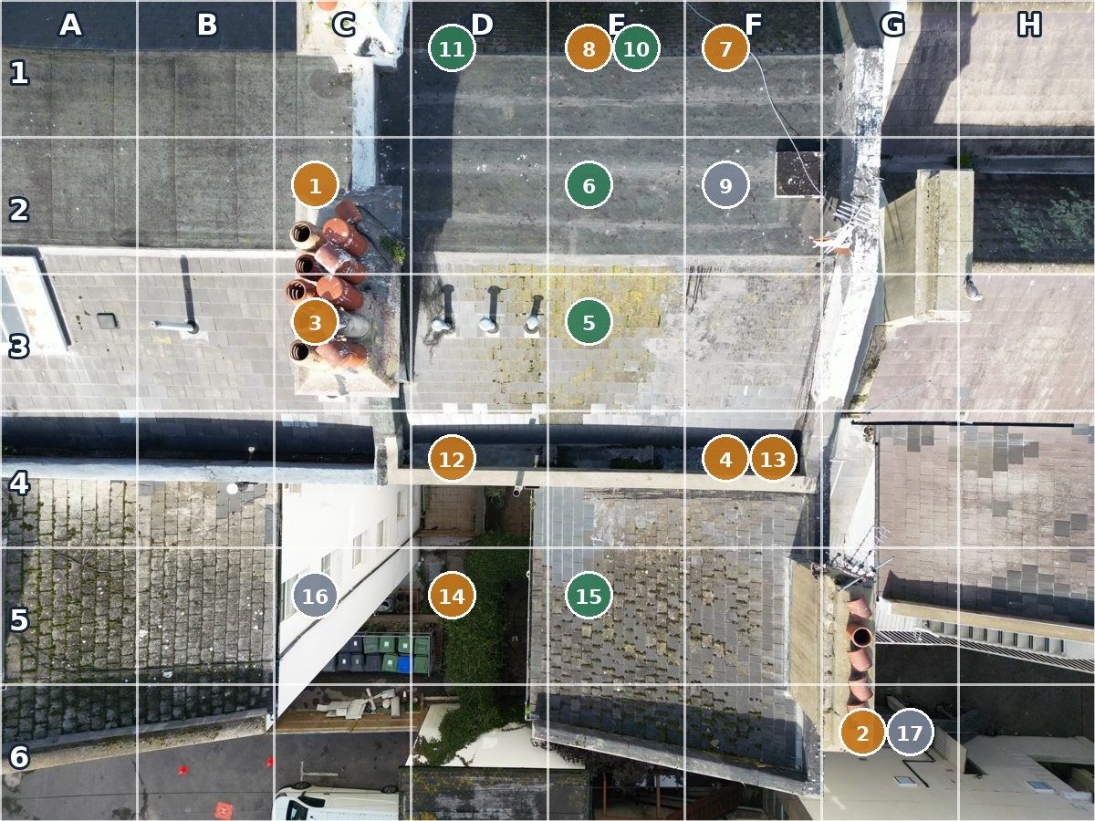
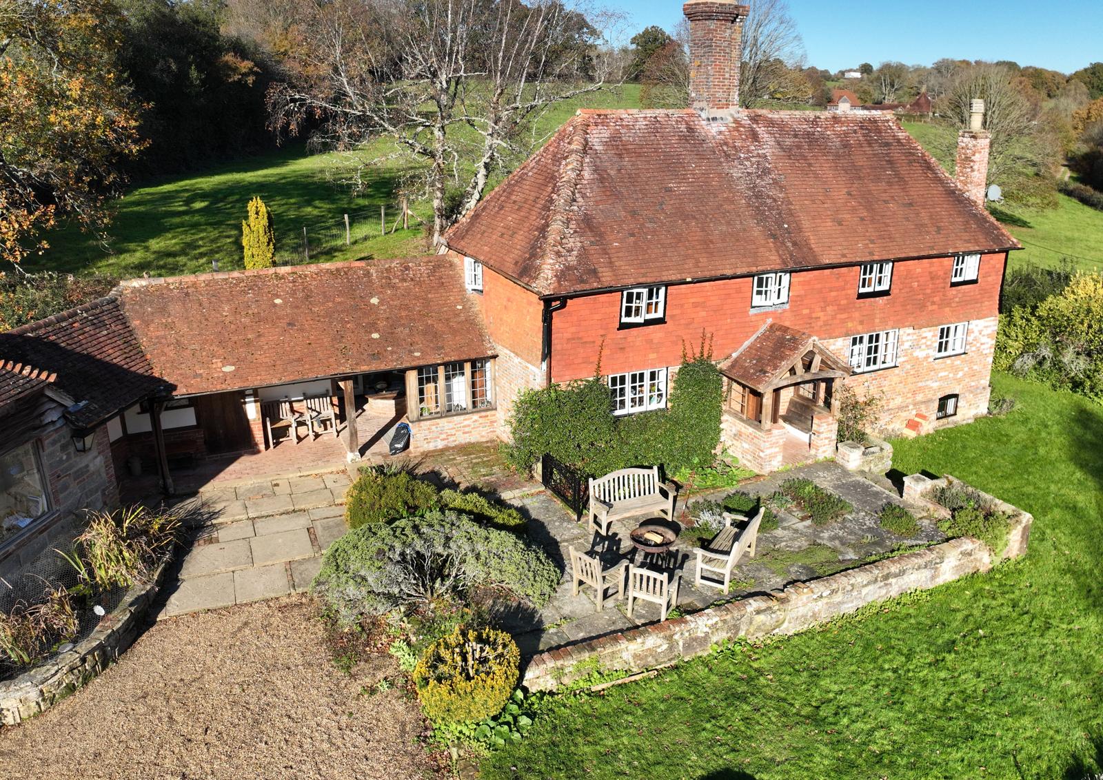
Farmhouse roof · chimneys, hips and slopesCondition record
ABCD 12 1 2 3 4
Captured13 Nov
Images203
Observations12 on the roof
RatingsCR2 ×8 · CR1 ×4
Example · reported damp, upstairs bedroomHazard investigation
1 2 ReportedMon 10:40 On siteWed · day 2 Summary sentThu · day 3
Deadline10 w/days
On site≤ 2 days
FindingCR2 · P3
SummaryNext day
Example · meadow and woodland edge, visit 2 of 5BNG monitoring
TQ 59 10OSGB · RTK FIX F1F2F3F4 GrasslandTrees and scrubHedgerow and trees
Visit2 of 5
Detail2 cm/px
Parcels3 mapped
ChangeScrub edge outlined
Example · Station Road, month 6 of 18Site progress
Block 1 · roof on Groundworks Spoil heap P1P2P3P4 33%
Visit6 · monthly
Positions4 fixed
Since lastRoof on Block 1
Delivered3 w/days
What
Drone inspection, monitoring and condition reporting for buildings, sites and land
For
Housing associations, councils, managing agents, surveyors, ecologists, contractors and estates
You get
Referenced photos, a map or marked-up plan, and a rating or change record for every item
Standard
Planned and flown with the discipline of commercial aviation
01 · Services

What we do

One method: a careful flight and a record you can act on. Pick the kind of work you do to see what we fly and what you get back.

Main service

Building condition records

The parts of a building that are hard, slow or costly to reach, recorded from the air.

  • Roofs, gutters, chimneys, parapets and upper walls
  • Every issue photographed, located on a plan and rated CR1 to CR3
  • Evidence for building surveys, maintenance plans, Section 20 consultations and insurers
  • Repeat visits from the same positions to track change

Get a price → See the price → Drone roof surveys

Social housing · Leasehold blocks · Surveyors
Awaab's Law

External hazard investigations

Checks of roofs, walls, chimneys and rainwater goods when a reported hazard must be investigated within the statutory timescales.

  • On site within two working days, no scaffold or access equipment
  • A summary for the tenant file, next working day: see a sample
  • Dated, referenced photographs for the repairs team and the record

Request an investigation → See the price →

Social housing · Councils · Repairs teams
For your practice

Capture for your survey or drawings

You keep the inspection and the opinion. We supply the part that otherwise needs a scaffold, a cherry picker or a ladder.

  • Capture only, while you are on site: every photograph the same day
  • Or a full Condition Record without you attending, written as prompts for your judgement
  • Measured orthophotos of roofs and elevations for drawing-up
  • An export pack that drops straight into your own report

Get a price → See the price → How it works for your practice

Surveyors · Architects · Managing agents
Construction

Site progress records

A monthly visit flown from the same positions every time, so month six lays over month one: for the client report, the valuation and the project record.

  • Fixed-position photographs, an orthomosaic and a change comparison each visit
  • Roof and facade records at handover for snagging and the O&M file
  • Delivered within three working days

Get a price → See the price → About site progress

Contractors · Developers · Project managers
Land

Biodiversity net gain monitoring

Aerial evidence for the 30-year monitoring every BNG site must report on, flown the same way each visit so year 3 lays over year 1: a baseline before works, evidence while habitat is created, condition visits each growing season.

  • An orthomosaic (one stitched overhead image you can measure from), habitat parcel areas and a change map on the British National Grid
  • Fixed-point photographs repeated every visit for the monitoring report
  • A data pack in the monitoring template's own sections, seven working days after the flight

Get a price → See the price → About BNG visits

Ecologists · Habitat banks · Landowners
02 · The record

What you receive

Whatever we fly, you get the same kind of thing back: a dated record in which every item is located, photographed and referenced. The four records differ only in what the items are located on.

Condition recordGridded plan of the buildingEvery roof, chimney, gutter and wall issue located on the plan, photographed, rated CR1 to CR3 and given a priority, with the register as a spreadsheet for your own report. Three working days.
Hazard investigationSummary for the case fileThe reported hazard, what was seen outside the home and where, dated photographs, a rating and what was not inspected, written to sit beside your surveyor's internal inspection. Next working day.
BNG monitoringMap on the British National GridOrthomosaic, habitat parcels with areas, a change map against the previous visit, fixed-point photographs and an accuracy statement, in the monitoring template's own sections. Seven working days.
Site progressFixed positions, month on monthPhotographs from the same marked positions each visit, an orthomosaic, a change comparison, close-ups of roofs and facades and six edited stills for the client report. Three working days.

Example: four rows from a condition record

RefElementObservationRating
A1-01TilesThree slipped tiles near the vergeCR2
C1-02ChimneyOpen joints in flashing, vegetation growthCR3
B2-03GutterSilt and moss at outlet, standing waterCR2
D2-04RidgeBedding sound, no movementCR1
CR1 No repair needed now CR2 Repair needed, not urgent CR3 Serious or urgent

Each item also carries a priority: P1 act now, P2 within 3 months, P3 within 12 months, P4 at the next planned cycle. The ratings are the pilot's prompts; the judgement stays with your surveyor.

Built to drop into your own reportEvery job comes as an export pack: numbered, captioned photographs, the register as a spreadsheet with the rating columns filled in, and the PDF. Nothing to retype.
Located, not just photographedOn a gridded plan, an elevation, a map or a marked position, so anyone can find it again.
Referenced photographsA close-up for each item, plus the full image set, each file named for what it shows.
A baseline to compareFlown from the same positions next time, so what has changed stands out.
03 · Recent work

What a record looks like

Two pieces of work, and a full record to download, so you can see exactly what arrives.

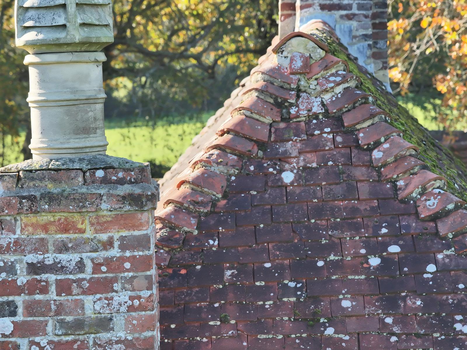
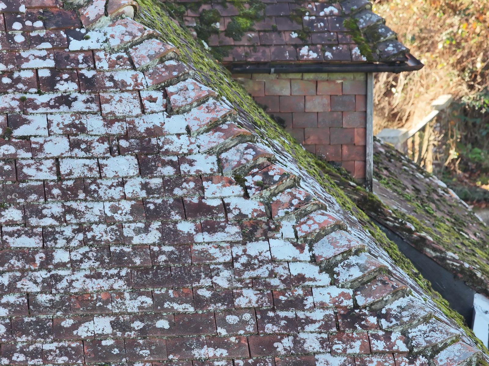
Close-up of bonnet hip tiles and a brick chimney with a clay pot
Hip tiles and chimney, photographed from 12 m away
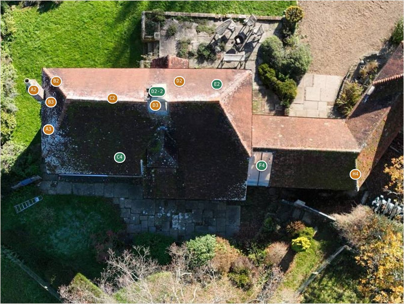
Vertical photograph of the farmhouse roof with twelve numbered observation pins
Each observation pinned on the roof plan
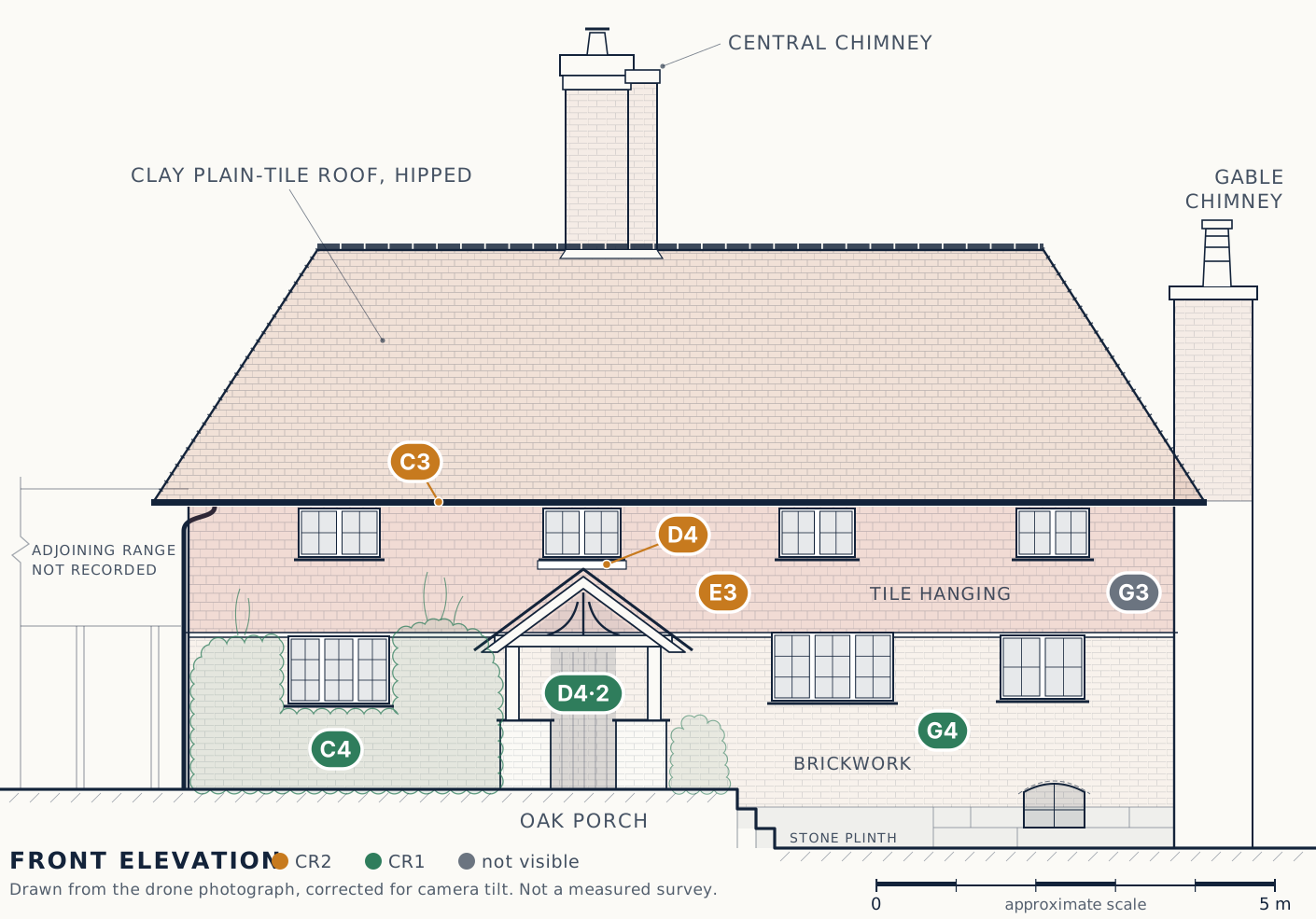
Line drawing of the farmhouse front elevation with seven observation pins
The front wall drawn as an elevation, seven observations pinned
Lichen-covered clay tiles and a mossy hip beside a tile-hung dormer
Moss and lichen on a shaded hip
Sample record

Download a full Condition Record

The Eastbourne record with the client's details removed: where each item is, what it is, how serious, what to do, and the photographs that show it. Six pages, plus a smaller copy for bid portals.

Download the sample (PDF, 2 MB) →   portal copy under 1 MB

04 · Why drones

How it compares

A drone doesn't replace your surveyor, ecologist or site manager. It gives them a complete, dated view sooner, more safely and for less, and the same view again next time.

The usual wayAssetWing drone record
Getting a viewScaffold, cherry picker or ladder; a day walking a site or a habitatNo access equipment; under an hour on site for most jobs
SafetyPeople working at heightEveryone stays on the ground
DisruptionEquipment on site, sometimes for days; work pausedA short visit; residents told in advance, site rules followed
What's recordedNotes and photos of what could be reached or walkedThe whole roof, site or habitat, every item located and referenced
Next timeHard to compare with last month or last yearSame positions each visit, so changes stand out
Where it ends upA folder of phone photosA record that drops into the surveyor's report, the case file, the monitoring return or the valuation
05 · How it works

From first call to finished record

The same five steps for every service, whatever the size of the job.

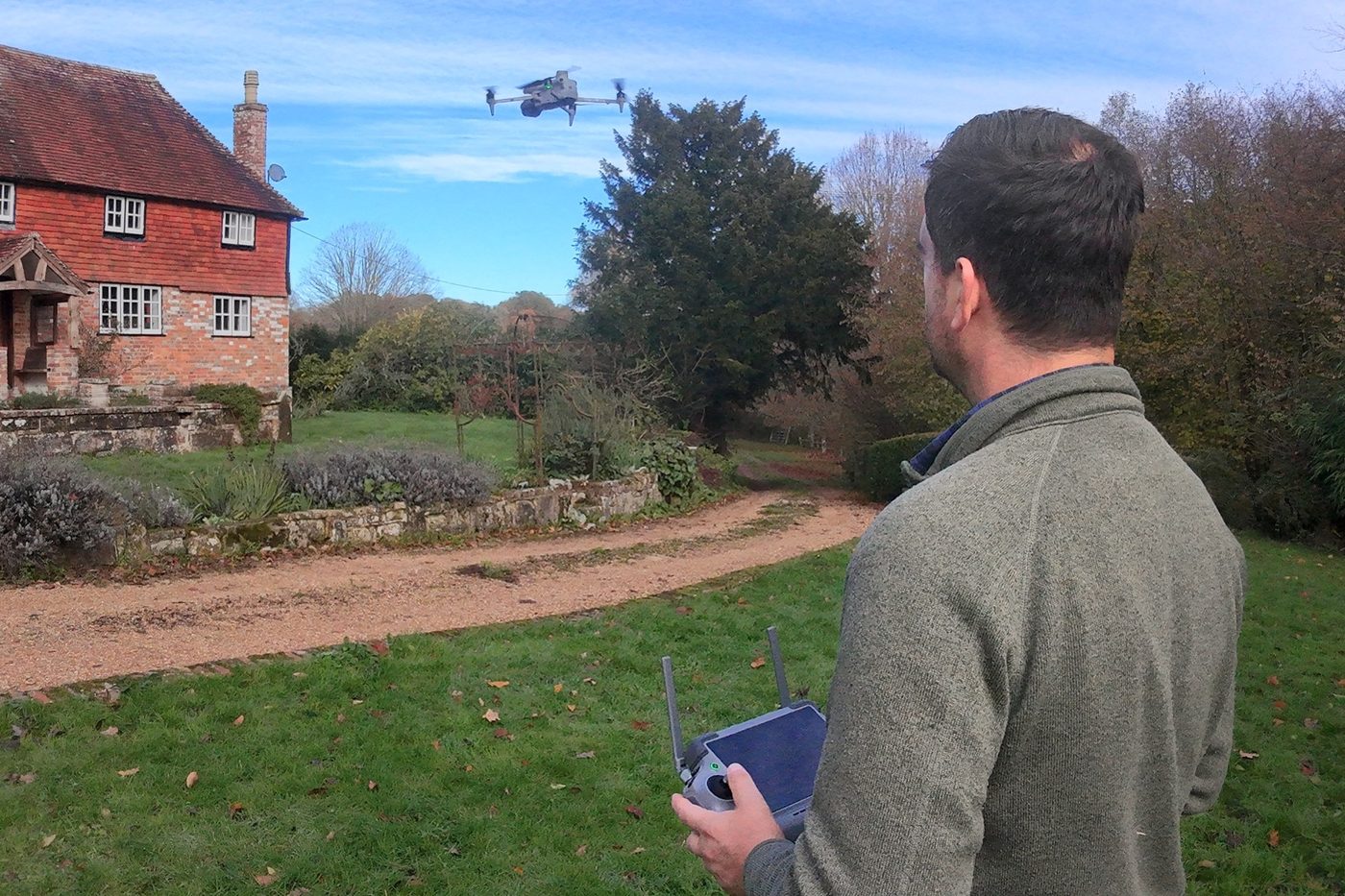
The pilot seen from behind, holding the controller, with the drone flying above the garden of a tile-hung brick house
Capture: the pilot stays on the ground and the aircraft does the climbing
  1. Step 1

    Scope

    A short call or the online form: the building, site or land, and what you need to know.

  2. Step 2

    Plan

    Airspace, access, residents' notices or site induction, and a written plan and risk assessment.

  3. Step 3

    Capture

    A short visit, usually under an hour for a building and a morning for a site or habitat, nobody at height.

  4. Step 4

    Record

    Hazard summary next working day; condition and progress records in three; habitat data pack in seven.

  5. Step 5

    Review

    We go through the record together. The next visit is flown from the same positions.

06 · Partners

Who we work with

AssetWing flies and measures. The professional judgement on what the record shows stays with the surveyor, architect or ecologist who instructs us.

Bond Macleod
Capture partner · Bexhill-on-Sea

Architects and building surveyors

Bond Macleod is an architecture and building surveying practice in Bexhill-on-Sea, working across East Sussex, Hastings and London: building surveys, defect and party-wall work, residential architecture, planning applications and the conservation of heritage buildings.

When a survey or project needs roofs, elevations, chimneys or a whole site recorded from the air, Bond Macleod instructs AssetWing. We fly it under our own Operator ID and insurance; their surveyors and architects work from the record. One instruction, one point of contact for the client, nobody at height.

  • Roof and high-level condition records for building surveys
  • Measured orthophotos of elevations and roofs for drawing-up
  • Party-wall and neighbour "before" records
  • Whole-site records for planning and conservation projects

Visit bondmacleod.co.uk 01424 439648

For other practices

Surveyors, architects and ecologists: the same arrangement is open to you

Instruct us job by job. We fly within five working days and deliver within three: orthophotos on the National Grid, a roof or facade record, a point cloud where it helps, and an accuracy statement with every job. Your findings, your drawings, your client.

  • Priced per visit by site size (see Prices); founder rate on your first five jobs
  • Extra time on site by the hour, agreed in advance
  • Flown by a CAA-certified pilot, £5m public liability on every job
  • No drawing or design work from us: the measured record is yours to draw from

How it works for your practice →

07 · About

Who's behind it

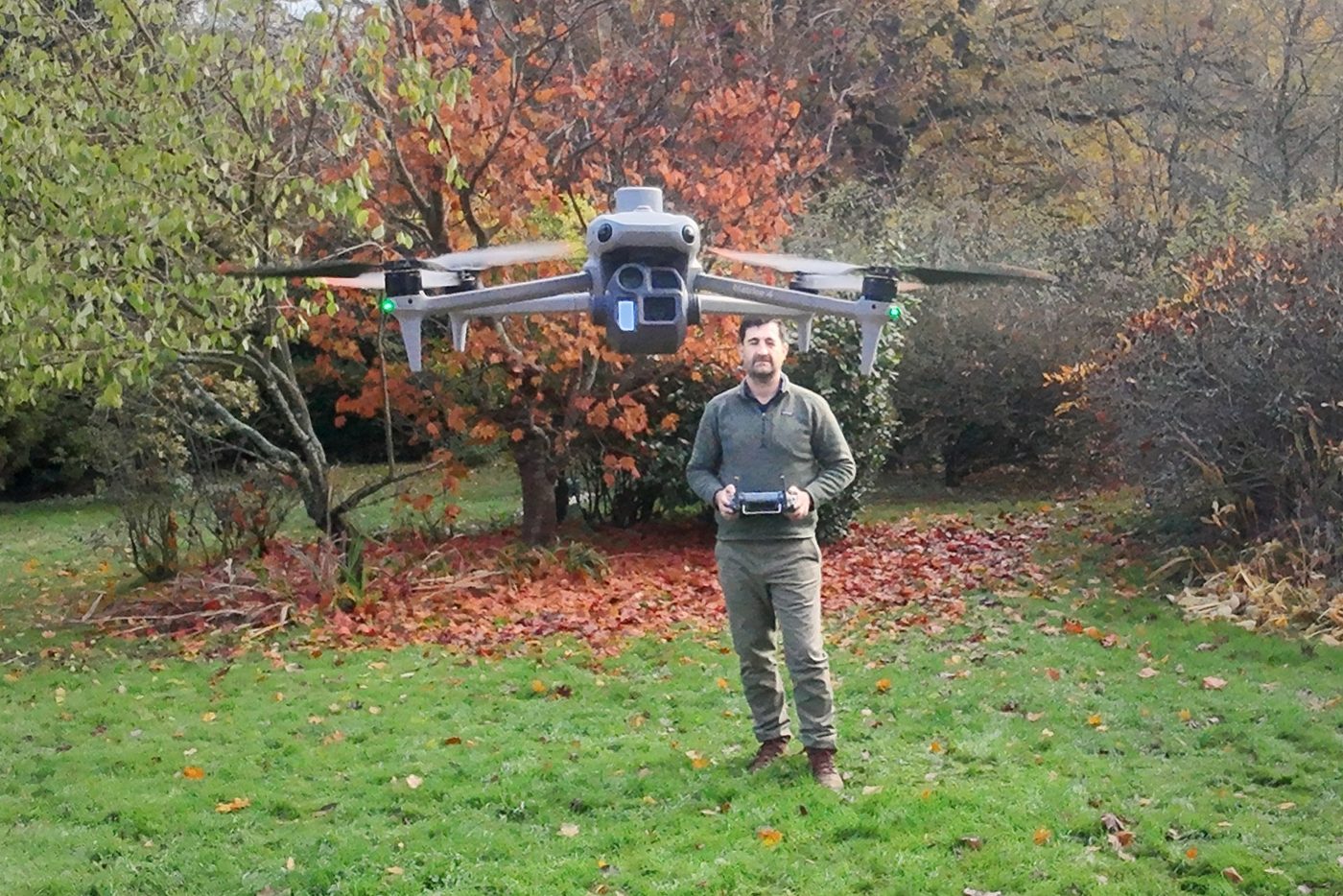
Lloyd Jankielsohn standing on a lawn holding the controller, with the Matrice 4E drone hovering in front of him
Lloyd Jankielsohn with the Matrice 4E

AssetWing was founded by Lloyd Jankielsohn, a professional pilot with airline and business-jet command experience in international operations.

Plan properly, brief everyone, follow the checklist and keep a record. That's how aircraft are flown, and it's how every AssetWing job is run.

In practice: a written plan and risk assessment before each visit, a defined point to stop if conditions change, and a logged record of every flight. Every job is flown by a CAA-certified pilot under the company's Operator ID, with £5m public liability cover bought for that job.

8,800 hrs
as a professional pilot
Captain
airline and business-jet command
CAA
certified pilot · registered operator GBR-OP-QX978LRS2JLD
£5m
public liability cover on every job · based in Polegate, East Sussex
08 · Questions

Common questions

What will I actually receive?

A Condition Record: a gridded plan with a reference, photograph, rating and priority for every issue, and the register as a spreadsheet. A hazard investigation: a dated summary for the case file. BNG monitoring: a georeferenced data pack in the monitoring template's sections. A site progress record: fixed-position photographs, an orthomosaic, a change comparison and edited stills. The full image set comes with all of them; see a sample record.

How soon can you come?

Usually within five working days of booking, weather permitting; a hazard investigation within two. The record follows within three working days of the flight. Call 07392 006453 if the date matters and we will tell you straight away what we can hold.

Do I need to be there?

No. We need the owner's permission to fly over the property, somewhere safe to take off, and a contact number for the day. Neighbours are told beforehand. Surveyors who want to be on site while we fly are welcome; the capture-only rate covers that.

Is it safe and legal to fly near homes?

Yes, when it's planned. Every flight follows CAA rules, is risk-assessed in advance and keeps 30 m from anyone not involved. Residents are told beforehand what is happening and why.

What about residents' privacy?

The camera is pointed at the building fabric, not into windows or gardens. Images are stored securely and used only for your inspection record.

Does this replace a building surveyor?

No. Nor your ecologist or site manager. It gives them a complete, current view of what they would otherwise need access equipment or a long walk to see, so their time goes on judgement. Opinions on cause, condition and the BNG metric stay with them.

How does this help with Awaab's Law?

The fixed timescales already apply to damp and mould. From 30 November 2026 they extend to excess cold, falls, structural, fire and electrical hazards. Where the cause may be outside the home, on the roof, in the gutters, at a chimney or parapet, we look within two working days and give you a dated, photographed summary for the investigation record and the repairs team. It sits alongside your surveyor's internal inspection.

What do you supply for BNG monitoring?

A repeatable data pack for your ecologist's Habitat Monitoring Report: a georeferenced orthomosaic, habitat parcel polygons with the area of each, a change map against the previous visit, fixed-point photographs from the same positions every year, dated evidence of management works, and a flight and accuracy statement. Your ecologist keeps the species, condition and metric work. Get a price: a pre-commencement baseline or works evidence now, condition monitoring from May 2027.

What is a site progress record?

A drone visit to a construction site, monthly or fortnightly, flown from the same marked positions every time so the photographs compare month to month. You receive the fixed-position photographs, an orthomosaic, a change comparison against the previous visit, close-ups of anything you ask us to watch and six edited stills, within three working days. Get a price.

What does a first job cost?

Prices are fixed per visit by the size of the site, with hazard investigations and BNG monitoring priced separately. The price list has every figure. Send the address and what you need, and a written quote follows within one working day.

Which areas do you cover?

East Sussex, West Sussex, Kent and Surrey, from Polegate near Eastbourne. Travel further afield is agreed in the quote.

What if the weather is bad, or you cannot fly?

If wind, rain or visibility make the flight unsafe, we tell you the same day and rebook at no extra charge. We check the airspace before we quote; where a site needs permission to fly, the quote says so and allows five working days for it. You can cancel free of charge up to two working days before the visit. How we work sets out the rest.

09 · Contact

Have a building, site or habitat that needs a record?

Three ways to start: get a price in one minute, book a call, or ask a question on this page. Every one gets a reply within one working day.

1 · Get a price
One-minute form →
A fixed price back within one working day
2 · Book a call
Pick a 30-minute slot →
Any day, 8 am to 6 pm
3 · Ask a question
Use the form on this page, call 07392 006453 or email hello@assetwing.co.uk
Reported hazard with a deadline?
Request an investigation →

We use your details only to reply to your enquiry. We don't share them. See our privacy notice.